Platting Deed Locations
| Metes & Bounds System Intro | Twp. & Range System Intro |
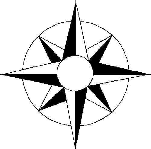
| Compass Points -vs- Degrees | Principal Meridian & Baseline Locations |
| Distance Conversion | Twp & Range Calculator |
NOTES:
The Metes &Bounds System
The Metes & Bounds system was generally used in the southern states, where the deed boundaries are given as directions and distances from some physical marker. With markers like "a dead oak", "three pines", and "the edge of Mr. Weaver's line", finding those lines a few hundred years later can become a real problem. Trees get cut down, creeks and rivers change their positions or may even disappear, and adjacent property will probably change hands many times -- leaving you to look for Mr. Weaver's deed and others. However, all may not be lost.
Without knowing the exact location, you can usually plat (plot) the shape of the property, or at least get close, by drawing the directions and distances given in the same scale as a map of the general area, then try to "fit" the plat on the map. For example, if you know that one side of the plat lies on the west side of a river, you can slide the plat along the river until you find one or more places where it seems to fit. This is what I do with a CAD (Computer Aided Design) program, and I've been very successful in most cases. Here are some tools you might need:
|
| ||||||||||||||||||||||||||||||||||||||||||||||||||||||||||||||||||||||||||||
The Federal Township & Range System
Rectangular land surveys have been used since the 1790s in most of the United States. The system is based on Principal Meridians (PMs) and Baselines. Townships, approximately six miles square, are numbered with reference to the PM and baseline. Ranges are the distances from the PM east or west and Townships from the baseline north or south. Every four townships a new baseline is established so that orthogonal meridians can remain north oriented.
Definitions
| Principal Meridian (PM) - Reference or beginning point for measuring east or west ranges.
Base Line - Reference or beginning point for measuring north or south townships. Range - Assigned to a township by measuring east or west of a principal meridian. Range Lines - North to South lines which mark township boundaries. Township Lines - East to West lines which mark township boundaries. |
| |||||||||||||||||||||||||||||||||||||||||||||
|
Section - Basic unit of the system. A square tract of land 1 mile on a side (640 acres).
Township - 36 sections arranged in a 6 mi. by 6 mi. array. Sections are numbered starting with #1 in the NE (upper right) corner, then left (W), then down one line & east, then down one line & west, etc. (see figure at right). |
| |||||||||||||||||||||||||||||||||||||||||||||
| The green area above can be further broken down into smaller parts |
| |||||||||||||||||||||||||||||||||||||||||||||
Typical land description
(of platt above)
SE1/4 of NW1/4 of Sec.14, T1N, R2E, 3rd PM
OK, But Where Is It?
Without knowing where the PM & baseline are, you're measuring from an unknown point. So the next step is to find the PM & baseline location as a starting point.
I recently had a query asking where a platt was, which included a "29th PM". Having a surveyor cousin check for a "29th PM", we found that modern books have no such PM. However, knowing that the platt was in FL, and since there's only one PM that covers that state, we determined that the "29th PM" must be "Tallahassee". The lesson here is that you may not find the PM as listed in the deed but, if you know the general area, you should be able to find it (the nearest one) in a table of PMs. Now, back to business.
In the case of the example in the diagrams above, checking a Table of Principal Meridians, I find that the 3rd PM is located in southern IL @ 89°08'54"N & 38°28'27"W. Now we have a starting point.
Next, we can narrow down the platt area by applying the Twp., Rng. & Sect. numbers. To keep things simple, let's find the upper left (NW) corner of the Sect.
|
Let's start with the vertical (Lat.) distance. Since we know that each Twp. is 6 mi. on a side, T1N's NW corner is 6 mi's up (N). Notice that if you're going north, you add 6 mi's for each Twp. #, giving a formula of distance=[Twp.*6]. However, if you're going south, that rule would put you on the SW corner, so you have to subtract 6 mi or use the formula distance=[(Twp.-1)*6]. To both of these, you then have to add or subtract a few miles, depending on which row the Sec. is in. To get the horizontal (Lon.) distance, you use the Rng.#'s. When going west, you multiply the Rng.# by 6 mi., giving a formula of dist=[Rng.*6] but, just as was the case above when going south, if you go east you have to subtract 6 mi. to keep from going to the NE corner, or dist=[(Rng.-1)*6]. To both of these, you then have to add or subtract a few miles, depending on which column the Sec. is in. (See formulae to the right.) |
Distance Formulae
|
OK, now let's do some calculations on the above "typical"
T1N Sec.14 = [1*6]-[2] = 4 mi. north
R2E Sec.14 = [(2-1)*6]+[4] = 10 mi. east
Therefore, the NW corner of Sec.14 is 4 mi. N & 10 mi. E of the PM/baseline of 89°08'54"N & 38°28'27"W. But, because of the "SE1/4 of NW1/4", we can refine this further to the NW corner of the property. Looking at the green diagram above, and remembering that this is a Sec. of 1 mi. by 1 mi., the NW corner is 1/4-mi S & 1/4-mi E, so:
NW corner of platt = (4-1/4)N & (10+1/4)E or 3.75-mi N & 10.25-mi E of the PM & baseline.
Now that you've suffered thru all the explanations & math, I'll make things easy for you.
"Section, Township & Range Calculator"
Just fill in the details from your deed, and you'll get the Lat/Lon of the NW corner of the property. Then, if you press the "Get Tiger" button, you'll see a map of the area with a red stick-pin marking the NW corner. Enjoy! <G>